CONTACT US   020 3129 3301

Our experts are here for you

Our passionate staff is with you through every step of your purchase and helps you choose the right gear that best suits your needs.

Mon-Fri 9am-12am / 2pm-7pm
(GMT+1)

020 3129 3301


With our Help Center

CONTACT
(= line.product.common.ancestorIds[1] || line.product.common.ancestorIds[0] || line.product.common.id =) (= line.quantity =) (= line.product.common.title =) (= line.unitAmountWithTaxes =) (= cartData.common.currencyCode =)
Generic_brand_banner

IGN

Filters
Filters selected Reset all
IGN Calvi Cargese Monte Cinto Monte Rotondo IGN Calvi Cargese Monte Cinto Monte Rotondo
  • £8.27

The IGN Calvi Cargese Monte Cinto Monte Rotondo map is very useful and features the main and local road networks, cycle paths, hiking trails as well as contour lines.  

IGN Map Chaine des Aravis Massif des Bauges Overview IGN Map Chaine des Aravis Massif des Bauges Back
  • £8.27

Ideal for preparing your hiking itineraries, the IGN Chaine des Aravis Massifs des Bauges map also helps you find your way during your expeditions.

IGN Diois Devoluy Haute Vallee de la Drôme IGN Diois Devoluy Haute Vallee de la Drôme
  • £8.27

The IGN Diois Devoluy Haute Vallee de la Drôme model is a useful map to guide you and help you anticipate your hiking itineraries in this pretty corner of France.

IGN Entre Leman et Mont-Blanc Chablais Faucigny IGN Entre Leman et Mont-Blanc Chablais Faucigny
  • £8.27

The IGN Entre Leman et Mont-Blanc Chablais Faucigny map has been designed to a scale of 1/75000 and will help you plan your excursions with contour lines, GR trails and points of interest.

IGN Foret D'orient Lac Du Der-Chantecoq IGN Foret D'orient Lac Du Der-Chantecoq
  • £8.27

Practical to help you plan the route of your hikes and bike rides, the Foret D'orient Lac Du Der-Chantecoq IGN map is packed with useful information.

IGN Forêt de Fontainebleau IGN Forêt de Fontainebleau
  • £8.61

Very practical, the Forêt de Fontainebleau map from IGN integrates useful information for your hikes and walks.

IGN Gavarnie Neouvielle Luchonnais Pic du Midi de Bigorre IGN Gavarnie Neouvielle Luchonnais Pic du Midi de Bigorre
  • £8.27

The IGN Gavarnie Neouvielle Luchonnais Pic du Midi de Bigorre model is a standard paper map featuring a wealth of useful information to guide you and help you prepare your hiking itineraries.

IGN Golfe Du Morbihan Belle-Ile et Groix Presqu'île de Quiberon IGN Golfe Du Morbihan Belle-Ile et Groix Presqu'île de Quiberon
  • £8.27

With the IGN Golfe Du Morbihan Belle-Ile et Groix Presqu'île de Quiberon map, prepare the itinerary of your expeditions with all the necessary information.

IGN Gorges et Monts D'Ardeche IGN Gorges et Monts D'Ardeche
  • £8.27

With all the useful information it's packed with, the IGN Gorges et Monts D'Ardèche map accompanies and guides you on your walks and hikes.

IGN Grandes Traversées du Jura IGN Grandes Traversées du Jura
  • £7.74

Designed on durable plastic-coated paper, the IGN Grandes Traversées du Jura map is packed with useful information to help you find your way around.

IGN Map Haut-Languedoc Overview IGN Map Haut-Languedoc Back
  • £8.27

Ideal for planning your hikes, the IGN Haut-Languedoc map is packed with practical information to guide you on your outings.

IGN Le Sentier des Douaniers Bretagne Sud IGN Le Sentier des Douaniers Bretagne Sud
  • £7.74

Designed at 1:100,000 scale, the IGN Sentier des Douaniers - Bretagne Sud map is packed with practical information to guide you along the GR 34.

Colour
  • IGN Le Sentier des Douaniers Bretagne Nord
  • IGN Le Sentier des Douaniers Bretagne Sud
IGN Les Chemins vers Saint Jacques De Compostelle IGN Les Chemins vers Saint Jacques De Compostelle
  • £6.53

Essential for preparing your itinerary on the roads to Santiago de Compostela, this IGN 922 Les Chemins vers Saint Jacques De Compostelle 1:1,000,000 map contains a wealth of useful information.

IGN Massif du Pilat Mont Forez IGN Massif du Pilat Mont Forez
  • £8.27

The IGN Massif du Pilat Mont Forez map provides essential information for preparing your hikes and finding your way around, such as the main, secondary and local road networks.

IGN Montagne Sainte-Victoire IGN Montagne Sainte-Victoire
  • £8.61

Ideal for preparing your outings and orienting yourself on hikes, the Montagne Sainte-Victoire map is an IGN map, designed on standard paper at a scale of 1:17,500.

IGN Pays Basque IGN Pays Basque
  • £8.27

With the IGN Pays Basque, you can prepare your hikes and bike rides with a wealth of useful information, such as contour lines and points of interest.

IGN Pointe du Raz Presqu'Ile de Crozon Ouessant les Abers IGN Pointe du Raz Presqu'Ile de Crozon Ouessant les Abers
  • £8.27

Explore the Pointe du Raz, the Crozon peninsula or the Ouessant les Abers island with this IGN map featuring all the information you need.

IGN Provence Sainte Victoire St Baume Calanques IGN Provence Sainte Victoire St Baume Calanques
  • £8.27

The IGN Provence Sainte Victoire St Baume Calanques map provides useful information to help you find your way around, such as hiking trails and points of interest.

IGN Pyrénées Ariegeoises Mont Valier Picque d'Estats IGN Pyrénées Ariegeoises Mont Valier Picque d'Estats
  • £8.27

The IGN Pyrenees map gives you all the practical information you need to find your way around the Ariege Pyrenees, Mont Valier or Picque d'Estats. It incorporates the main, secondary and local motorway networks, as well as cycle paths, GR trails, points of interest and contour lines.

Features of the IGN Pyrénées Ariegeoises Mont Valier Picque d'Estats:

  • Scale: 1:75,000
  • Support: Standard paper
  • Integral representation of the road network (motorway, main, secondary and local), GR and GR de pays of the FFrandonnée
  • Information on how to get to the many outdoor activity sites and cultural and historical treasures
  • Stopover gîtes and refuges to fix the various stages of the route
  • Bicycle routes and cycle paths
  • Altitude indications with contour lines and dimensioned points to assess the difficulty of the routes
  • GPS grid, for locating the position (in X and Y) provided by a GPS on the map
  • 5 extracts from TOP 25 (scale 1:25000 scale) are integrated
Colour
  • IGN Pyrénées Ariegeoises Mont Valier Picque d'Estats
  • IGN Pyrénées Catalanes Font-Romeu Massif du Canigou
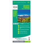
IGN Pyrénées Catalanes Font-Romeu Massif du Canigou IGN Pyrénées Catalanes Font-Romeu Massif du Canigou
  • £8.27

The IGN Pyrenees map lets you explore the Catalan Pyrenees, Font-Romeu and the Massif du Canigou, helping you find your way around the road, GR and bike networks.

Colour
  • IGN Pyrénées Ariegeoises Mont Valier Picque d'Estats
  • IGN Pyrénées Catalanes Font-Romeu Massif du Canigou
IGN Map Saint Malo Côte d'Emeraude Mont-Saint-Michel Overview IGN Map Saint Malo Côte d'Emeraude Mont-Saint-Michel Back
  • £8.27

The IGN Saint Malo Côte d'Emeraude Mont-Saint-Michel map provides invaluable information to help you prepare and enjoy your walks and hikes in this beautiful part of France.

IGN St Jacques De Compostelle De Moissac à Roncevaux IGN St Jacques De Compostelle De Moissac à Roncevaux
  • £7.79

Indispensable map for hikers along the Camino de Santiago de Compostela, with precise route and useful tourist information for organizing stages, published by IGN at a scale of 1:100,000.
.

IGN TOP75016 Cezallier Monts Du Cantal IGN TOP75016 Cezallier Monts Du Cantal
  • £8.27

The IGN TOP75016 topographic map shows not only the road network in the Cézallier and Monts Du Cantal area, but also all the details you need to plan your hiking itinerary.

IGN Verdon - Lac de Sainte-Croix - Plateau de Valensole IGN Verdon - Lac de Sainte-Croix - Plateau de Valensole
  • £8.27

The IGN Verdon - Lac de Sainte-Croix - Plateau de Valensole map allows you to prepare your itineraries for hiking in this exceptional place.

IGN Vignemale Pic de Ger Vallee d'Ossau IGN Vignemale Pic de Ger Vallee d'Ossau
  • £8.27

The IGN Vignemale Pic de Ger Vallee d'Ossau map invites you to discover this pretty corner of France, and gives you all the information you need to find your way around.

IGN Vosges du Nord Mont Sainte Odile IGN Vosges du Nord Mont Sainte Odile
  • £8.27

The IGN map of the Vosges du Nord is a practical model that includes motorway, main, secondary and local networks, as well as lots of other information to help you find your way around.

Colour
  • IGN Vosges du Nord Mont Sainte Odile

Loading...

1 2 3 4 5