CONTACT US   020 3129 3301

Our experts are here for you

Our passionate staff is with you through every step of your purchase and helps you choose the right gear that best suits your needs.

Mon-Fri 9am-12am / 2pm-7pm

(GMT+1)

020 3129 3301       

Closed the 21/04 and the 01/05


With our Help Center

CONTACT
(= line.product.common.ancestorIds[1] || line.product.common.ancestorIds[0] || line.product.common.id =) (= line.quantity =) (= line.product.common.title =) (= line.unitAmountWithTaxes =) (= cartData.common.currencyCode =)

Raised-relief map

Filters
Filters selected Reset all
3DMAP Raised-relief map Le Massif Des Ecrins Overview 3DMAP Raised-relief map Cadre 43x63 cm Bois Overview
  • £59.33

This 3D map of the Ecrins massif will help you discover this region in all its detail and give you an idea of the relief it offers.

Deniveles Raised-relief map Cadre 50x70 cm Black Overview Deniveles Raised-relief map Cadre 50x70 cm Black Back
  • £27.62

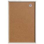
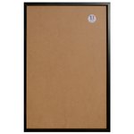
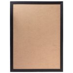
Exactly matching the dimensions of the 3D cards manufactured in Auvergne by the Dénivelés company, this frame is made of wood.

Colour
  • Deniveles Raised-relief map Cadre 50x70 cm Black Overview
  • Deniveles Raised-relief map Cadre 50x70 cm Brut Overview
Deniveles Raised-relief map Cadre 50x70 cm Brut Overview Deniveles Raised-relief map Cadre 50x70 cm Brut Back
  • £27.62

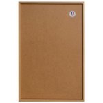
Exactly matching the dimensions of the 3D cards manufactured in Auvergne by the Dénivelés company, this frame is made of wood.

Colour
  • Deniveles Raised-relief map Cadre 50x70 cm Black Overview
  • Deniveles Raised-relief map Cadre 50x70 cm Brut Overview
3DMAP Raised-relief map Le Massif Des Ecrins Overview 3DMAP Raised-relief map Le Massif Des Ecrins Back
  • £33.92

This 3D map of the Ecrins massif will help you discover this region in all its detail and give you an idea of the relief it offers.

3DMAP Raised-relief map Les Alpes Françaises Et Ses Massifs Alpins Overview 3DMAP Raised-relief map Les Alpes Françaises Et Ses Massifs Alpins Back
  • £33.92

On this beautiful 3D map, you can admire the entire French Alps, from Lake Geneva to the Mediterranean coast, from the Rhône valley to the Italian border.

3DMAP Raised-relief map Les Alpes Françaises Et Ses Massifs Alpins Overview 3DMAP Raised-relief map Cadre 43x63 cm Bois Overview
  • £59.33

On this beautiful 3D map, you can admire the entire French Alps, from Lake Geneva to the Mediterranean coast, from the Rhône valley to the Italian border.

3DMAP Raised-relief map Bauges-Belledonne-Chartreuse Overview 3DMAP Raised-relief map Bauges-Belledonne-Chartreuse Back
  • £33.92

The 3DMAP Bauges-Belledonne-Chartreuse is a handy relief map that lets you learn more about the area with a wealth of geographical and tourist information in particular.

3DMAP Raised-relief map Bauges-Belledonne-Chartreuse Overview 3DMAP Raised-relief map Cadre 43x63 cm Bois Overview
  • £59.33

The 3DMAP Bauges-Belledonne-Chartreuse is a handy relief map that lets you learn more about the area with a wealth of geographical and tourist information in particular.

Deniveles Raised-relief map Carte Des Pistes Portes Du Soleil Avoriaz Châtel Chapelle d’Abondance Overview Deniveles Raised-relief map Carte Des Pistes Portes Du Soleil Avoriaz Châtel Chapelle d’Abondance Detail
  • £48.45

The 3D Des Pistes Portes Du Soleil Avoriaz Châtel Chapelle d'Abondance vertical drop map will help you learn all about the region's topography, ski slopes and lifts.

Colour
  • Deniveles Raised-relief map Carte Des Pistes Portes Du Soleil Avoriaz Châtel Chapelle d’Abondance Overview
  • Deniveles Raised-relief map Carte Des Pistes Portes Du Soleil Les Gets – Morzine – Avoriaz Overview
Deniveles Raised-relief map Carte Des Pistes Portes Du Soleil Avoriaz Châtel Chapelle d’Abondance Overview Deniveles Raised-relief map Cadre 50x70 cm Black Overview
  • £76.07

The 3D Des Pistes Portes Du Soleil Avoriaz Châtel Chapelle d'Abondance vertical drop map will help you learn all about the region's topography, ski slopes and lifts.

3DMAP Raised-relief map Le Lac D'annecy Overview 3DMAP Raised-relief map Le Lac D'annecy Back
  • £16.91

Would you like to see Lake Annecy and the surrounding peaks in relief on your wall? With this 3D map from 3DMAP, you'll have the pleasure of discovering this hilly region dotted with wonders.

3DMAP Raised-relief map Le Lac D'annecy Overview 3DMAP Raised-relief map Cadre 22.5x32.5 cm Bois Overview
  • £29.66

Would you like to see Lake Annecy and the surrounding peaks in relief on your wall? With this 3D map from 3DMAP, you'll have the pleasure of discovering this hilly region dotted with wonders.

3DMAP Raised-relief map Le Massif Du Mont-Blanc Overview 3DMAP Raised-relief map Le Massif Du Mont-Blanc Detail
  • £33.92

Discover France's highest peak and its massif with this 3D map from 3DMAP. A magnificent work made in France.

3DMAP Raised-relief map Le Massif Du Mont-Blanc Overview 3DMAP Raised-relief map Cadre 43x63 cm Bois Overview
  • £59.33

Discover France's highest peak and its massif with this 3D map from 3DMAP. A magnificent work made in France.

3DMAP Raised-relief map Les Pyrénnées Overview 3DMAP Raised-relief map Les Pyrénnées Back
  • £33.92

Travel through the Pyrenees with your fingers running over this beautifully detailed 3D map. From ski resorts to peaks, including all the region's points of interest.

Loading...

1 2 3 4 5 6
7
...