French IGN maps
Detailed maps for hiking in France
Because they hold a lot of precise information, IGN maps are an integral part of the equipment of hikers looking to discover France. Every map is at the 1:25000 scale. They display waymarked routes, including GR and GRP trails, as well as paths, forest trails, roads and bridleways. The IGN also offers altitude data and contour lines to indicate altitude differences. You'll also have the directions to reach a specific point such as a rock, glacier or river. For long distance adventures, you’ll find refuges, both guarded and unguarded, as well as huts and shelters. To make it easier to locate yourself, IGN maps feature GPS coordinates. Allowing you to give your position if needed or to enter coordinates in your device for easy navigation. Available for various areas or regions, the choice is large and covers all possible needs. Discover a wide range of maps and topo guides on Glisshop.co.uk.
Read more Show less

-
£8.01
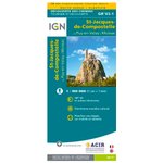
The IGN St Jacques de Compostelle map from Puy-en-Velay to Moissac is ideal for preparing your itinerary and finding your bearings on the GR 65.


-
£8.01
The practical IGN St Jacques de Compostelle de Moissac à Roncesvalles map takes you along the GR 65, providing a wealth of useful information.


-
£8.01
The IGN St Jacques de Compostelle model from Roncesvalles to Compostela is a very practical map for preparing your itinerary and finding your bearings when hiking the GR 65.
INCLUDED
DAY RETURNS
Fixed costs


-
£8.55
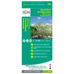
The IGN Pyrenees map gives you all the practical information you need to find your way around the Ariege Pyrenees, Mont Valier or Picque d'Estats. It incorporates the main, secondary and local motorway networks, as well as cycle paths, GR trails, points of interest and contour lines.
Features of the IGN Pyrénées Ariegeoises Mont Valier Picque d'Estats:
- Scale: 1:75,000
- Support: Standard paper
- Integral representation of the road network (motorway, main, secondary and local), GR and GR de pays of the FFrandonnée
- Information on how to get to the many outdoor activity sites and cultural and historical treasures
- Stopover gîtes and refuges to fix the various stages of the route
- Bicycle routes and cycle paths
- Altitude indications with contour lines and dimensioned points to assess the difficulty of the routes
- GPS grid, for locating the position (in X and Y) provided by a GPS on the map
- 5 extracts from TOP 25 (scale 1:25000 scale) are integrated
Loading...
What is an IGN map?
An IGN map is a map edited by the Institut Géographique National (similar to the Ordnance Survey in the UK) with the particularity of featuring the altitude differences of the terrain. Generally, when speaking about IGN maps, we refer to 1:2500 scale maps. On these maps, 1cm represents 250m on the ground. By comparison, road maps showing a whole country are generally available in 1:1 000 000 scale. 1cm then represents 10km. You understand that an IGN 1:2500 scale map offers an impressive level of details very useful to hikers, especially combined with the topographic elements featured as well. It is then possible to prepare detailed hiking routes, anticipating difficulties linked to the altitude differences.
How to see the topography of the terrain?
Like stated above, thanks to IGN maps it is possible to recognize the topography of the terrain, meaning the altitude differences. To do so, one has to know how to properly read the topographic data of the IGN map. To read the altitude differences on an IGN map, the points indicating the altitude are used, it is symbolized by numbers in black, as well as the contour lines which can, with experience, give a mental representation of the terrain. To understand if the terrain goes up or down, several reference points are at your disposal. The altitude rating of two points enables to know which way the slope goes. Some contour lines are traced bolder, they are the ones on which the altitude is indicated. You can also use the direction in which the numbers are read, as this corresponds to the direction of the ascent. Finally, for the specific case of isolated depressions, an arrow points towards the bottom.


