CONTACT US   020 3129 3301

Our experts are here for you

Our passionate staff is with you through every step of your purchase and helps you choose the right gear that best suits your needs.

Mon-Fri 9am-12am / 2pm-7pm

(GMT+1)

020 3129 3301  

Closed the 1st , 8th , 9th of May


With our Help Center

CONTACT
(= line.product.common.ancestorIds[1] || line.product.common.ancestorIds[0] || line.product.common.id =) (= line.quantity =) (= line.product.common.title =) (= line.unitAmountWithTaxes =) (= cartData.common.currencyCode =)

Page 3 – Hiking guides and maps

Filters
Filters selected Reset all
IGN Map 4251OT Monte d'Oro, Monte Rotondo, Parc naturel régional de Corse OverviewIGN Map 4251OT Monte d'Oro, Monte Rotondo, Parc naturel régional de Corse Back
  • £12.19

The IGN 4251OT Monte d'Oro, Monte Rotondo, Parc naturel régional de Corse map lets you discover this region in great detail. Scale 1:25,000

IGN Map 4252OT Monte Renoso, Bastelica, Parc naturel régional de Corse OverviewIGN Map 4252OT Monte Renoso, Bastelica, Parc naturel régional de Corse Back
  • £12.19

The IGN 4252OT Monte Renoso, Bastelica, Parc naturel régional de Corse map lets you discover this entire region in great detail. Scale 1:25,000

IGN Map 903 France Grandes Randonnees OverviewIGN Map 903 France Grandes Randonnees Back
  • £6.83

Use this IGN 903 France Grandes Randonnées map to find your way around mainland France on the GR® (long-distance hiking trails) and GR® de Pays.

IGN Map Alpes du Sud OverviewIGN Map Alpes du Sud Back
  • £6.19

Discover the Southern Alps by car, on foot or by bike with this IGN map containing all the practical information you need to find your way around.

Chamina Edition Guidebook Auvergne - Les 50 Plus Beaux Sentiers OverviewChamina Edition Guidebook Auvergne - Les 50 Plus Beaux Sentiers Back
  • £12.74

The Chamina guide Auvergne Edition - Les 50 Plus Beaux Sentiers takes you on a tour of Auvergne's most beautiful landscapes, with signposted itineraries of varying length and difficulty.

Chamina Edition Guidebook Beaufortain Tarentaise OverviewChamina Edition Guidebook Beaufortain Tarentaise Back 10% off
  • £9.10

The Chamina guidebook Beaufortain Tarentaise Edition presents 20 hiking itineraries suitable for all levels, with IGN maps, information on places of interest, safety tips and useful addresses.

IGN Map Chemin de Stevenson GR70 OverviewIGN Map Chemin de Stevenson GR70 Back
  • £8.10

The IGN Chemin de Stevenson GR70 map helps you find your way along the GR70, delivering a wealth of practical information.

3DMAP La Haute-Savoie 3DMAP La Haute-Savoie
  • £36.31

This 3D map of Haute Savoie is made in France. It features the region's sporting and tourist attractions, which will soon hold no secrets for you.

Deniveles Raised-relief map Massif Des Bauges OverviewDeniveles Raised-relief map Massif Des Bauges Side
  • £49.96

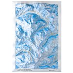
The Dénivelés Massif des Bauges relief map is an accurate, detailed representation of the mountains in the Parc Naturel Régional. It is ideal for exploring the region and decorating your home.

Deniveles Raised-relief map Massif Du Beaufortain OverviewDeniveles Raised-relief map Massif Du Beaufortain Side
  • £49.96

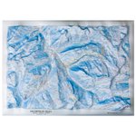
The Dénivelés du Massif du Beaufortain relief map offers an accurate representation of this region with lots of practical information to help you learn more.

Chamina Edition Guidebook Pyrénées 20 Refuges De Montagne En Famille 64-65 Tome 1 OverviewChamina Edition Guidebook Pyrénées 20 Refuges De Montagne En Famille 64-65 Tome 1 Back 10% off
  • £9.10

The Chamina hiking guide Pyrenees Edition T1 20 Refuges De Mont Agne En Famille 64-65 presents 23 welcoming refuges in the Pyrenees for all levels.

Colour
  • Chamina Edition Guidebook Pyrénées 20 Refuges De Montagne En Famille 64-65 Tome 1 Overview
  • Chamina Edition Guidebook Pyrénées 20 Refuges De Montagne En Famille 64-65 Tome 2 Overview
Chamina Edition Guidebook Refuges Des Écrins OverviewChamina Edition Guidebook Refuges Des Écrins Back 10% off
  • £9.10

Guide to the Ecrins refuges from Chamina Edition, with 20 walks to different refuges in the massif, detailed presentation of emblematic refuges, detailed cartography, practical information and useful addresses.

Deniveles Raised-relief map Domaine Le Grand Massif OverviewDeniveles Cadre 50x70 cm Black
  • Recommended price

    £77.26

    -5%

    £73.34
3DMAP La Haute-Savoie 3DMAP Cadre Bois
  • Recommended price

    £63.52

    -5%

    £60.33

This 3D map of Haute Savoie is made in France. It features the region's sporting and tourist attractions, which will soon hold no secrets for you.

Deniveles Raised-relief map Les 3 Vallées - Les Menuires/Val Thorens OverviewDeniveles Cadre 50x70 cm Black
  • Recommended price

    £77.26

    -5%

    £73.34
3DMAP Les Hautes-Alpes 3DMAP Cadre Bois
  • Recommended price

    £63.52

    -5%

    £60.33
Deniveles Raised-relief map Massif Des Bauges OverviewDeniveles Cadre 50x70 cm Black
  • Recommended price

    £77.17

    -5%

    £73.25

The Dénivelés Massif des Bauges relief map is an accurate, detailed representation of the mountains in the Parc Naturel Régional. It is ideal for exploring the region and decorating your home.

Deniveles Raised-relief map Massif Du Beaufortain OverviewDeniveles Cadre 50x70 cm Black
  • Recommended price

    £77.17

    -5%

    £73.25

The Dénivelés du Massif du Beaufortain relief map offers an accurate representation of this region with lots of practical information to help you learn more.

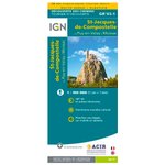
IGN Map St Jacques De Compostelle De Moissac à Roncevaux OverviewIGN Map St Jacques De Compostelle De Moissac à Roncevaux Detail 10% off
  • £8.14

Indispensable map for hikers along the Camino de Santiago de Compostela, with precise route and useful tourist information for organizing stages, published by IGN at a scale of 1:100,000.
.

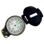
SOL Compass Map Compass OverviewSOL Compass Map Compass Detail 10% off
  • £9.01

The Map Compass from Sol is a compass offering an accurate and easy reading, allowing you to zoom on your map thanks to its magnifying glass function

Loading...