CONTACT US   020 3129 3301

Our experts are here for you

Our passionate staff is with you through every step of your purchase and helps you choose the right gear that best suits your needs.

Mon-Sat 9am-12am / 2pm-7pm
(GMT+1)

020 3129 3301       

Closed 01/11 and 11/11


With our Help Center

CONTACT
(= line.product.common.ancestorIds[1] || line.product.common.ancestorIds[0] || line.product.common.id =) (= line.quantity =) (= line.product.common.title =) (= line.unitAmountWithTaxes =) (= cartData.common.currencyCode =)

Page 4 – Hiking guides and maps

Filters
Filters selected Reset all
Deniveles Raised-relief map Carte Des Pistes Portes Du Soleil Les Gets – Morzine – Avoriaz Overview Deniveles Raised-relief map Cadre 50x70 cm Black Overview
  • £80.55

The Dénivelés Carte Des Pistes Portes Du Soleil Les Gets - Morzine - Avoriaz is a detailed 3D map of the region's ski resorts with their ski runs and lifts.

3DMAP Le Lac D'annecy 3DMAP Le Lac D'annecy
  • £17.91

Would you like to see Lake Annecy and the surrounding peaks in relief on your wall? With this 3D map from 3DMAP, you'll have the pleasure of discovering this hilly region dotted with wonders.

3DMAP Le Lac D'annecy

Would you like to see Lake Annecy and the surrounding peaks in relief on your wall? With this 3D map from 3DMAP, you'll have the pleasure of discovering this hilly region dotted with wonders.

Out of stock
3DMAP Le Massif Du Vercors 3DMAP Raised-relief map Le Massif Du Vercors Detail
  • £35.91

3DMAP's Le Massif Du Vercors 3D map details tourist and sports attractions at a scale of 1:340,000.

3DMAP Le Massif Du Vercors 3DMAP Cadre 43x63 cm Bois
  • £62.82

3DMAP's Le Massif Du Vercors 3D map details tourist and sports attractions at a scale of 1:340,000.

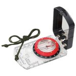
Herbertz Visée Miroir Black Herbertz Visée Miroir Black
  • Recommended price

    £17.91

    -40%

    £10.71
Colour
  • Herbertz Visée Miroir Black
Chamina Edition 22 Balades En Raquettes En Auvergne Chamina Edition 22 Balades En Raquettes En Auvergne
  • £10.71

The guide Chamina Edition 22 Balades En Raquettes En Auvergne (Snowshoeing in the Auvergne) allows you to enjoy nature in the Auvergne through beautiful day or half-day hikes.

IGN 2530SB Aigueperse, Châtel-Guyon, Manzat IGN 2530SB Aigueperse, Châtel-Guyon, Manzat
  • £12.06

Perfect for discovering the hiking trails in this area, IGN map 2530SB Aigueperse, Châtel-Guyon, Manzat is your best ally.

IGN 2531SB Clermont-Ferrand IGN 2531SB Clermont-Ferrand
  • £12.06

Perfect for discovering Clermont-Ferand and the surrounding area, the 1:25,000 scale IGN 2531SB map offers unparalleled accuracy.

IGN 3531OT Megève, Col des Aravis IGN 3531OT Megève, Col des Aravis
  • £12.51

The IGN 3531OT Megève, Col des Aravis map allows you to discover this region in great detail. Scale 1:25,000

IGN 3532OT Massif du Beaufortain, Moûtiers, la Plagne IGN 3532OT Massif du Beaufortain, Moûtiers, la Plagne
  • £12.06

The IGN 3532OT Massif du Beaufortain, Moûtiers, la Plagne map lets you discover the whole of this region in great detail. Scale 1:25,000

IGN 4252OTR Monte Renoso, Bastelica, Parc naturel régional de Corse - Résistante IGN 4252OTR Monte Renoso, Bastelica, Parc naturel régional de Corse - Résistante
  • £15.21

The IGN 4252OTR Monte Renoso, Bastelica, Parc naturel régional de Corse map lets you discover this region in great detail. Scale 1:25,000

IGN 4253ETR Aiguilles de Bavella, Solenzara, Parc naturel régional de Corse - Résistante IGN 4253ETR Aiguilles de Bavella, Solenzara, Parc naturel régional de Corse - Résistante
  • £15.21

IGN map 4253ETR Aiguilles de Bavella, Solenzara, Parc naturel régional de Corse - Résistante allows you to discover this region in great detail. Scale 1:25,000

Deniveles Raised-relief map Aiguilles-D'arves, Galibier & Thabor (Summer) Overview Deniveles Raised-relief map Aiguilles-D'arves, Galibier & Thabor (Summer) Detail
  • £51.21

The Déniveles Aiguilles-D'arves, Galibier & Thabor (Summer) is a relief map of the Cerces range in the Alps, it will be a superb wall decoration for mountain enthusiasts.

Deniveles Raised-relief map Aiguilles-D'arves, Galibier & Thabor (Summer) Overview Deniveles Raised-relief map Cadre 50x70 cm Black Overview
  • £80.46

The Déniveles Aiguilles-D'arves, Galibier & Thabor (Summer) is a relief map of the Cerces range in the Alps, it will be a superb wall decoration for mountain enthusiasts.

Deniveles Raised-relief map Aix Les Bains Overview Deniveles Raised-relief map Aix Les Bains Detail
  • £51.21

Made in Auvergne by Dénivelés, this 3D map of Aix Les Bains and the surrounding area lets you immerse yourself in the terrain and plan future escapades.

Deniveles Raised-relief map Aix Les Bains Overview Deniveles Raised-relief map Cadre 50x70 cm Black Overview
  • £80.46

Made in Auvergne by Dénivelés, this 3D map of Aix Les Bains and the surrounding area lets you immerse yourself in the terrain and plan future escapades.

3DMAP Annecy 3DMAP Raised-relief map Annecy Side
  • £35.91

3DMAP's Annecy 3D map offers a detailed view of the region, including tourist and sports attractions, ideal for adventure seekers.

3DMAP Annecy 3DMAP Cadre 43x63 cm Bois
  • £62.82

3DMAP's Annecy 3D map offers a detailed view of the region, including tourist and sports attractions, ideal for adventure seekers.

Deniveles Raised-relief map Belledonne Nord Overview Deniveles Raised-relief map Belledonne Nord Detail
  • £51.30

The 3D Dénivelés Belledonne Nord map illustrates every detail of the massif, from ridges to valleys, for an immersive and realistic experience.

Loading...

1 2 3 4 5 6 7 8 9
10 ... 14
...