34542364
34903160
Massif Du Sancy (Winter)
https://www.glisshop.co.uk/maps-guides/deniveles/massif-du-sancy-winter-34903160
Deniveles
Men
Women
34903160
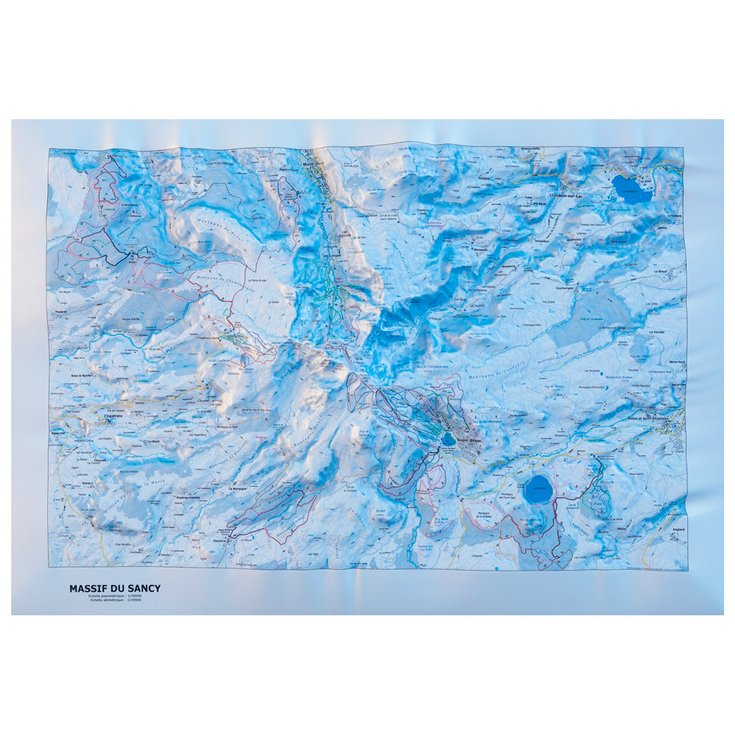
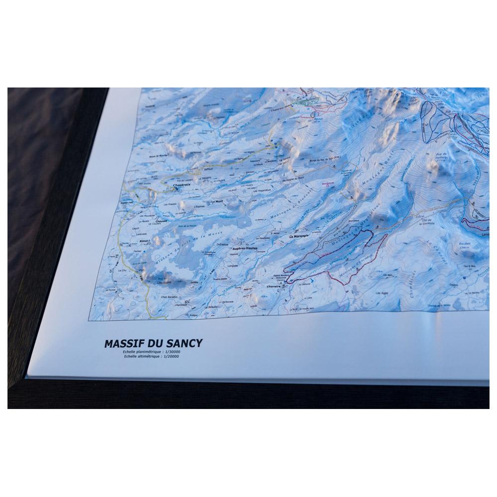
The Dénivelés Massif Du Sancy Winter is a raised relief map of the Massif du Sancy in winter, made in Auvergne (France), it represents in great details this area at a 1/35000 scale.
https://glisshop-glisshop-fr-storage.omn.proximis.com/Imagestorage/imagesSynchro/0/0/8b869cf516c255f9e25065b0cf523a4824f4b58a_E22DENIBIV220920_DENI0648674_0.jpeg
https://glisshop-glisshop-fr-storage.omn.proximis.com/Imagestorage/imagesSynchro/0/0/9eec398dceb5417a0005188627fdd33a6f30fb62_E22DENIBIV220920_DENI0648674_10.jpeg
https://glisshop-glisshop-fr-storage.omn.proximis.com/Imagestorage/imagesSynchro/0/0/624e5730dbe983239ed8a0516bb88dd1181705b1_E22DENIBIV220920_DENI0648674_11.jpeg
https://glisshop-glisshop-fr-storage.omn.proximis.com/Imagestorage/imagesSynchro/0/0/c6acb8b07da73dfbc11ac30a936014e179b69681_E22DENIBIV220920_DENI0648674_12.jpeg
InStock
51.21
GBP
51.21
GBP_VAT_royaume_uni
SEK_VAT_france
646.25
646.25
SEK
packs always have stock if there is a price
InStock
SEK_VAT_france_corse
646.25
646.25
SEK
packs always have stock if there is a price
InStock
SEK_VAT_royaume_uni
646.25
646.25
SEK
packs always have stock if there is a price
InStock
SEK_VAT_espagne
651.64
646.25
SEK
packs always have stock if there is a price
InStock
SEK_VAT_italie
657.02
646.25
SEK
packs always have stock if there is a price
InStock
SEK_VAT_allemagne
640.86
646.25
SEK
packs always have stock if there is a price
InStock
SEK_VAT_pays_bas
651.64
646.25
SEK
packs always have stock if there is a price
InStock
SEK_VAT_belgique
651.64
646.25
SEK
packs always have stock if there is a price
InStock
SEK_VAT_suisse
582.16
646.25
SEK
packs always have stock if there is a price
InStock
SEK_VAT_suede
673.18
646.25
SEK
packs always have stock if there is a price
InStock
SEK_VAT_danemark
646.25
646.25
SEK
packs always have stock if there is a price
InStock
SEK_VAT_monaco
646.25
646.25
SEK
packs always have stock if there is a price
InStock
SEK_VAT_luxembourg
630.09
646.25
SEK
packs always have stock if there is a price
InStock
SEK_VAT_irlande
646.25
646.25
SEK
packs always have stock if there is a price
InStock
SEK_VAT_portugal
646.25
646.25
SEK
packs always have stock if there is a price
InStock
SEK_VAT_autriche
646.25
646.25
SEK
packs always have stock if there is a price
InStock
SEK_VAT_pologne
646.25
646.25
SEK
packs always have stock if there is a price
InStock
SEK_VAT_finlande
675.87
646.25
SEK
packs always have stock if there is a price
InStock
SEK_VAT_slovenie
646.25
646.25
SEK
packs always have stock if there is a price
InStock
GBP_VAT_france
51.21
51.21
GBP
packs always have stock if there is a price
InStock
GBP_VAT_france_corse
51.21
51.21
GBP
packs always have stock if there is a price
InStock
GBP_VAT_espagne
51.64
51.21
GBP
packs always have stock if there is a price
InStock
GBP_VAT_italie
52.06
51.21
GBP
packs always have stock if there is a price
InStock
GBP_VAT_allemagne
50.78
51.21
GBP
packs always have stock if there is a price
InStock
GBP_VAT_pays_bas
51.64
51.21
GBP
packs always have stock if there is a price
InStock
GBP_VAT_belgique
51.64
51.21
GBP
packs always have stock if there is a price
InStock
GBP_VAT_suisse
46.13
51.21
GBP
packs always have stock if there is a price
InStock
GBP_VAT_suede
53.34
51.21
GBP
packs always have stock if there is a price
InStock
GBP_VAT_danemark
51.21
51.21
GBP
packs always have stock if there is a price
InStock
GBP_VAT_monaco
51.21
51.21
GBP
packs always have stock if there is a price
InStock
GBP_VAT_luxembourg
49.93
51.21
GBP
packs always have stock if there is a price
InStock
GBP_VAT_irlande
51.21
51.21
GBP
packs always have stock if there is a price
InStock
GBP_VAT_portugal
51.21
51.21
GBP
packs always have stock if there is a price
InStock
GBP_VAT_autriche
51.21
51.21
GBP
packs always have stock if there is a price
InStock
GBP_VAT_pologne
51.21
51.21
GBP
packs always have stock if there is a price
InStock
GBP_VAT_finlande
53.56
51.21
GBP
packs always have stock if there is a price
InStock
GBP_VAT_slovenie
51.21
51.21
GBP
packs always have stock if there is a price
InStock
CHF_VAT_france
54.62
54.62
CHF
packs always have stock if there is a price
InStock
CHF_VAT_france_corse
54.62
54.62
CHF
packs always have stock if there is a price
InStock
CHF_VAT_royaume_uni
54.62
54.62
CHF
packs always have stock if there is a price
InStock
CHF_VAT_espagne
55.08
54.62
CHF
packs always have stock if there is a price
InStock
CHF_VAT_italie
55.53
54.62
CHF
packs always have stock if there is a price
InStock
CHF_VAT_allemagne
54.17
54.62
CHF
packs always have stock if there is a price
InStock
CHF_VAT_pays_bas
55.08
54.62
CHF
packs always have stock if there is a price
InStock
CHF_VAT_belgique
55.08
54.62
CHF
packs always have stock if there is a price
InStock
CHF_VAT_suisse
49.21
54.62
CHF
packs always have stock if there is a price
InStock
CHF_VAT_suede
56.9
54.62
CHF
packs always have stock if there is a price
InStock
CHF_VAT_danemark
54.62
54.62
CHF
packs always have stock if there is a price
InStock
CHF_VAT_monaco
54.62
54.62
CHF
packs always have stock if there is a price
InStock
CHF_VAT_luxembourg
53.26
54.62
CHF
packs always have stock if there is a price
InStock
CHF_VAT_irlande
54.62
54.62
CHF
packs always have stock if there is a price
InStock
CHF_VAT_portugal
54.62
54.62
CHF
packs always have stock if there is a price
InStock
CHF_VAT_autriche
54.62
54.62
CHF
packs always have stock if there is a price
InStock
CHF_VAT_pologne
54.62
54.62
CHF
packs always have stock if there is a price
InStock
CHF_VAT_finlande
57.13
54.62
CHF
packs always have stock if there is a price
InStock
CHF_VAT_slovenie
54.62
54.62
CHF
packs always have stock if there is a price
InStock
EUR_VAT_france
56.9
56.9
EUR
packs always have stock if there is a price
InStock
EUR_VAT_france_corse
56.9
56.9
EUR
packs always have stock if there is a price
InStock
EUR_VAT_royaume_uni
56.9
56.9
EUR
packs always have stock if there is a price
InStock
EUR_VAT_espagne
57.37
56.9
EUR
packs always have stock if there is a price
InStock
EUR_VAT_italie
57.85
56.9
EUR
packs always have stock if there is a price
InStock
EUR_VAT_allemagne
56.43
56.9
EUR
packs always have stock if there is a price
InStock
EUR_VAT_pays_bas
57.37
56.9
EUR
packs always have stock if there is a price
InStock
EUR_VAT_belgique
57.37
56.9
EUR
packs always have stock if there is a price
InStock
EUR_VAT_suisse
51.26
56.9
EUR
packs always have stock if there is a price
InStock
EUR_VAT_suede
59.27
56.9
EUR
packs always have stock if there is a price
InStock
EUR_VAT_danemark
56.9
56.9
EUR
packs always have stock if there is a price
InStock
EUR_VAT_monaco
56.9
56.9
EUR
packs always have stock if there is a price
InStock
EUR_VAT_luxembourg
55.48
56.9
EUR
packs always have stock if there is a price
InStock
EUR_VAT_irlande
56.9
56.9
EUR
packs always have stock if there is a price
InStock
EUR_VAT_portugal
56.9
56.9
EUR
packs always have stock if there is a price
InStock
EUR_VAT_autriche
56.9
56.9
EUR
packs always have stock if there is a price
InStock
EUR_VAT_pologne
56.9
56.9
EUR
packs always have stock if there is a price
InStock
EUR_VAT_finlande
59.51
56.9
EUR
packs always have stock if there is a price
InStock
EUR_VAT_slovenie
56.9
56.9
EUR
packs always have stock if there is a price
InStock
/Hiking & camping/Maps - Guides
/Hiking & camping
brand - 34541435
211232 - 1
107027 - GLIS_NAME_TYPO_PRODUCT_38870
109123 - Sans
21127769 - 21127765
21127769 - 21127766
1323041 - 1386911
1323041 - 1386913
1323041 - 26542690


