
3DMAP
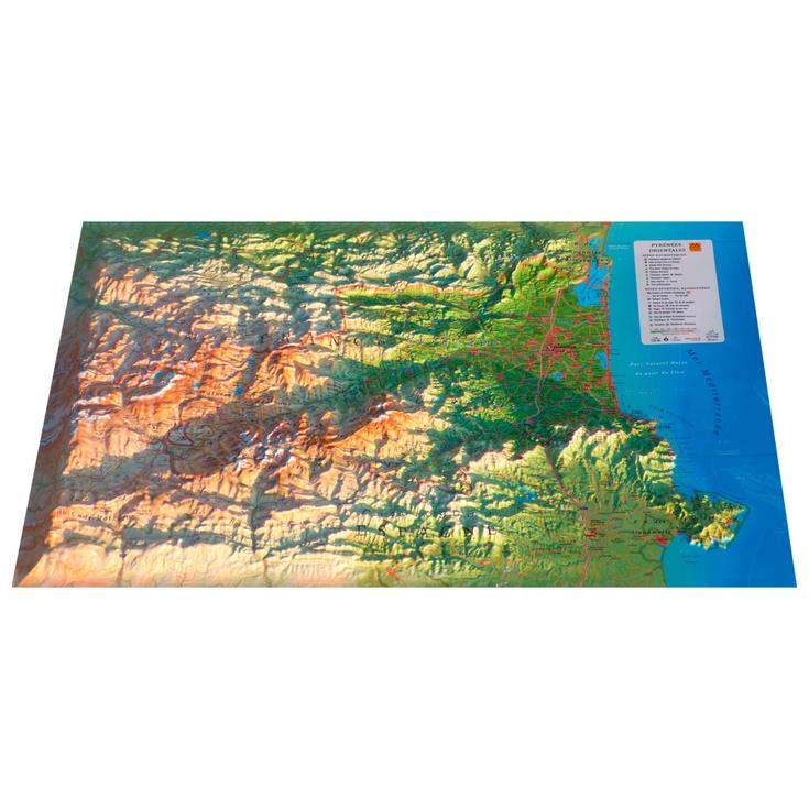
Les Pyrénées-Orientales + Frame
Image not available
Les Pyrénées-Orientales + Frame
- Customer reviews
Select Raised-relief map
+
Included
Raised-relief map 3DMAP Cadre 43x63 cm
SpecificationsEarliest delivery 2026-10-16T01:00:00+02:00
Product description — Les Pyrénées-Orientales
3DMAP maps are made in France and bring a new dimension to cartography, both literally and figuratively. Thanks to 3D processing software developed specifically for these maps, an exceptional level of finish is achieved, making these maps as beautiful as they are detailed. Here, the entire Pyrénées Orientales region is detailed in 3D. You'll find all the great sites of Occitanie, natural sites, but also sporting sites, paragliding, skiing, via ferrata, etc.
Technical features:
- General data: Hydrological, natural and hypsometric data - Administrative data
- Tourist sites: Plus beaux villages de France, Ville et Pays d'Art et d'Histoire, Grands sites Occitanie, Patrimoine culturel, Musées, Patrimoine religieux, Sites naturels, Cascades, Sites préhistoriques, Grottes, Belvédères, Tables d'orientation
- Sports sites, hiking: Sentiers de Grandes Randonnées, Tour du Canigou, Tour du Carlit, Refuges and gîtes, Alpine ski resorts, Nordic ski resorts, Via Ferrata, Spa resorts, Beaches, White water activities, Paragliding sites (www.ffvl.fr), Take-offs, Landings, Airports, Aerodromes
- Dimensions : 410 x 610 mm
Planimetric scale : 1 / 200 000
Altimetric scale : 1 / 150 000
Made in France
Frame sold separately
This description is an automatic translation. Please contact us if you have any further questions.

Alexis
Accessory expert
"Some look for functionality, others for style or performance. Whatever it is, we'll find it together and make sure we add the safety dimension to it! Call me on 020 3129 3301."
Technical data Raised-relief map Les Pyrénées-Orientales
-
- Gender
- Men
- Women
-
- EAN code
- 9791097206208
-
- Reference nr
- 3DMA0206846
-
- SKU
- PO25
-
- Destination
- France